Geography

Vision
Our geography curriculum provides the knowledge to allow our pupils to see connections between places, people, and environments in the world we live.
Curriculum Design: How our curriculum is constructed and why?
The geography curriculum is structured so that pupils learn substantive and disciplinary content at the same time—pupils learn both geographical ‘facts’ and how to make sense of them simultaneously. When pupils learn geography, they tackle these two closely linked types of content, each dependent on the other. Any inadequacy in one will weaken the other, and each plays a vital part in securing scope, coherence, rigour, and sequencing. In the progression map substantive geographical knowledge is divided into three overarching strands, which are referenced in the National Curriculum KS1 and KS2 programme of study.
The three substantive strands are:
• Locational knowledge: Understanding local, national and globally significant places.
• Environmental, physical, and human geography. For example, migration, climate zones, biomes, distribution of natural resources.
• Geographical skills and fieldwork: For example, using maps and globes; collecting first-hand evidence.
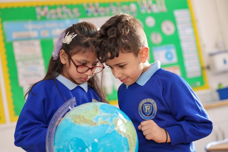
Our Early Years setting provides pupils with a crucial developmental stage in their educational journey that allows them to explore and experience the world around them. Through first-hand experiences and fieldwork, pupils explore and begin to understand the world and their place within it. Pupils begin to acquire important geographical vocabulary in EYFS that provides the foundations for geographical learning in KS1 and KS2.
In Key Stage 1, pupils begin their journey in geography with a study of the local area. They then move outwards to study the United Kingdom and the British seaside, and outwards again to gain an overview of Earth and its continents and oceans. Pupils then study a contrasting location within Kenya, Africa.
Through Key Stage 2, pupils develop their understanding of locations, places, processes, and people. In Lower Key Stage 2, they use their knowledge of the UK to understand settlements and land use before exploring Europe and North and South America. The exploration of these continents includes identifying the location and characteristics of a range of the most significant human and physical features, as well as the opportunity to explore three places in more depth and compare them to their own locality. Pupils also learn about climate, climate zones, rivers, and rainforests. In Upper Key Stage 2, pupils explore Asia before focussing once again on the wider world in the biomes unit. They explore the human and physical characteristics of Asia and learn about mountains and natural disasters, such as volcanoes and earthquakes. A case study of a natural disaster allows pupils to see the impact on both a place and the people within it. In Year 6, when looking at the world, pupils consider the global challenges faced in the movement of people, growing populations, the distribution of natural resources, fair trade, and the impact of climate change. They will also discover what they can learn from different maps of the world and draw their own maps based on fieldwork within their own locality.
Curriculum Delivery: What our curriculum looks and feels like in action?
In EYFS, curiosity about key geographical knowledge is developed through the provision which enables pupils to consider the 'what', the 'where', and the 'how' of our world. They begin to make sense of the world and learn about local geographical features like local road signs, shops and outdoor spaces.
In the primary phase, each unit has an enquiry question which is answered with a written outcome. The subject-specialist teachers have intellectual preparation time together, a crucial touchpoint in identifying misconceptions and practising the delivery of geographical concepts in preparation for teaching. A Knowledge Organiser is shared with the pupils in both their exercise and homework books, outlining what each geographer needs to know as an entry point to each aspect of the unit. This document sequences the unit into lessons, identifying the key knowledge to be taught each lesson. As the unit progresses, the children revise the previous week’s learning both in the Do Now and in their homework books.
Pupils in Y1-Y2 use maps, globes, atlases, and texts to retrieve information and practice fundamental skills. Pupils in Y3-6 build on these skills and also begin to use data to engage critically with geographical processes. Enquiry questions for each unit, answered with a formal written response, require primary pupils to demonstrate this understanding at length at the end of each unit.
Impact: How do we know our pupils are learning, understanding and remembering our intended curriculum?
In alignment with assessment in the Early Years, practitioners observe the children in play, use skilful interactions to comment and question, supporting children to deepen and share their geographical understanding. Children show what they know by making comments and asking questions which are captured as ‘memorable moments’, usually in pupil voice, photographs or observations.
In the primary phase, enquiry questions for each unit - answered with a formal written response - require our pupils to demonstrate understanding at length. Pupils’ writing is also formally assessed against national standards, meaning teachers assess their ability to communicate understanding in written form. Quizzes are also used at the start and end of units to formatively assess what our children have learnt, and the data from this informs planning for future ‘Do Nows’ and mini-whiteboard activities. Question-level analysis enables teachers to identify strengths and weaknesses across cohorts. During the lesson, ‘Well Worn Paths’ are ordered lists of students which the teachers follow, prioritising the highest-leverage pupils first. These paths are used to inform live feedback, enabling teachers to assess success against the lesson objective and collect live data.
The summative and formative data collected from quizzes informs future units. Medium-term plans include highlighted aspects of the geography curriculum, so teachers are aware of cohorts being secure, partially-met or not-met in key indicators.
Enrichment in Geography
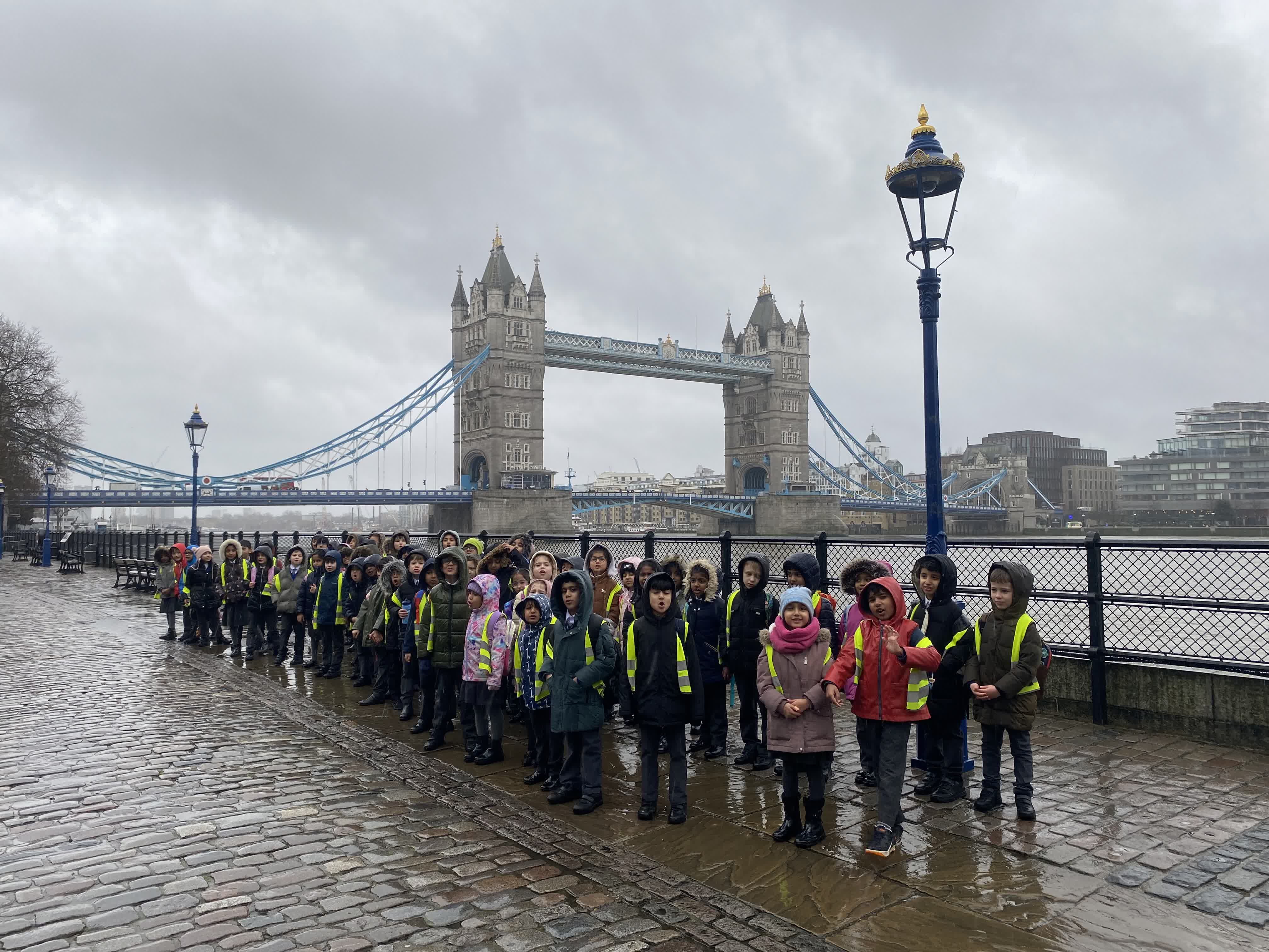
We feel passionately that the study of geography is also a matter of citizenship as it helps young people to encounter and engage with their world. Therefore, locational knowledge forms a big part of our geography curriculum, so we interleave local field work across many of our units. For example, pupils will use maps to navigate their way from school to key local landmarks, such as the Roxbourne Mini-Railway and Roxbounre Park. In EYFS and KS1, pupils will go on walks around the local area and visit the street names which were the inspiration behind the Housepoint names. Throughout our extensive enrichment programme, pupils will largely travel by train from the local tube station (Rayners Lane) where they'll experience the local walk there and travelling into central London using the Underground Tube Map.
You can find more about our enrichment programme here.